|
Activities For Grades 3 - 5
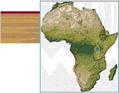
Where are Ghana, Uganda, Rwanda,
South Africa, Botswana and Senegal?
Purpose:
To
practice basic map skills while reviewing the location and physical
features of Africa.
Materials:
Wall maps, globes, atlases, Internet access, and other reference
materials
Map of the World for each student
Index cards
Suggested Activities:
Using available globes and atlases, have students work in pairs
to label and color the
United States, your state, Africa, Ghana, Uganda, Rwanda, South
Africa, Botswana and
Senegal on the map of the world. Add major oceans. Determine
distance in miles from your
home state to the colored countries, and between the countries on
the President’s
trip.
Ask a travel agent to come in and explain how they determine air
routes to places like
Ghana, Uganda, Rwanda, South Africa, Botswana and Senegal. Have
students plot the routes
on their maps. If possible, make copies of flight schedules so
students can practice
reading tables.
Divide the class into five groups, and assign each group a
geographic area (Europe,
Asia, North America/Central America, South America, Africa). Have
students label a set of
index cards with the names of the countries in that region (one
country per card). Collect
and shuffle the cards, then have students choose one. Ask students
to make up two more
index cards for the country they drew -- one card for three facts
about that country's
geography, and another with three facts about its people/culture.
Students can use the
cards to play "Concentration", to make a bulletin board,
or as study aids.
Shuffle
the country name cards and randomly distribute them so that every
student has one. Have
students group themselves by categories of your
choice,
e.g., continents, hemispheres, language, and so on.
|

![[White House icon]](/New/images/home_pin.gif)
![[Help Desk icon]](/New/images/help_pin.gif)